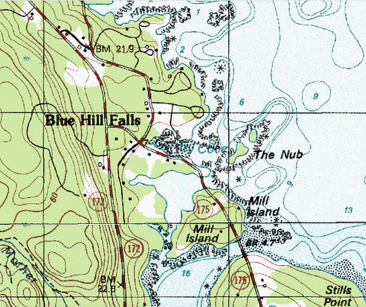
Welcome! This site will focus on what at one time had been called the "Tide Mill District" (or neighborhood), which includes the land/waters from the Blue Hill Falls and the Sedgwick Town Line to Bragdon Brook. It was an area of Plantation #5 first settled in 1762 on Mill Island.
Who were these first settlers in the Blue Hill area? They were mainly of English, Irish and Scottish ancestry. The rocky coast and close access to good fishing and hunting must have appealed to them. There were also trees for building materials. In 1763, John Roundy and Joseph Wood built a small mill adjacent to today's Mill Island, an Island nestled between what is now Conary Cove, the Blue Hill Falls and a tidal cove, today's Mill Pond.
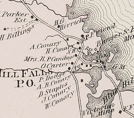
For perspective, the photos below are of the area known as Blue Hill Falls (north & west of the Falls Bridge). The land south of the falls is the Blue Hill Neck and was known as such well into the 20th century, but has come to be referenced as South Blue Hill. The two neighborhoods were effectively separated by water until the first iron bridge was built in 1883, though bridges of wood that were vulnerable to high water and ice existed there for about 30 years prior. The area included two district schools and two post offices - the South Blue Hill Post Office (23 June 1886 to 15 September 1923) and the Blue Hill Falls Post Office (May 1, 1852 to January 8, 2005).
The two schools (SH) are annotated with arrows on the map to the left though neither exist today - nor do the Post Office activities. The old Blue Hill Falls PO building on Conary Cove does exist, but was moved further back from the road as it grew wider and displaced property and buildings. It sits on the Herrick property and has light blue siding. The Blue Hill Falls School at the head of Conary Cove, can be seen in the slideshow below and stood into the 1930's.
A map of the area from Annie Clough's book, "Head of the Bay," is shown and the book is viewable and downloadable below.
Who were these first settlers in the Blue Hill area? They were mainly of English, Irish and Scottish ancestry. The rocky coast and close access to good fishing and hunting must have appealed to them. There were also trees for building materials. In 1763, John Roundy and Joseph Wood built a small mill adjacent to today's Mill Island, an Island nestled between what is now Conary Cove, the Blue Hill Falls and a tidal cove, today's Mill Pond.
For perspective, the photos below are of the area known as Blue Hill Falls (north & west of the Falls Bridge). The land south of the falls is the Blue Hill Neck and was known as such well into the 20th century, but has come to be referenced as South Blue Hill. The two neighborhoods were effectively separated by water until the first iron bridge was built in 1883, though bridges of wood that were vulnerable to high water and ice existed there for about 30 years prior. The area included two district schools and two post offices - the South Blue Hill Post Office (23 June 1886 to 15 September 1923) and the Blue Hill Falls Post Office (May 1, 1852 to January 8, 2005).
The two schools (SH) are annotated with arrows on the map to the left though neither exist today - nor do the Post Office activities. The old Blue Hill Falls PO building on Conary Cove does exist, but was moved further back from the road as it grew wider and displaced property and buildings. It sits on the Herrick property and has light blue siding. The Blue Hill Falls School at the head of Conary Cove, can be seen in the slideshow below and stood into the 1930's.
A map of the area from Annie Clough's book, "Head of the Bay," is shown and the book is viewable and downloadable below.
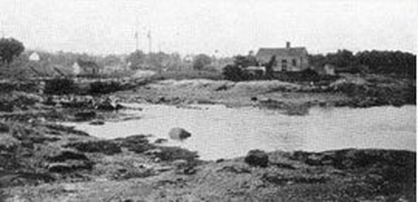
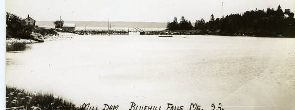
The Tide Mill Dam (with wooden bridge - angular trusses) and Benjamin Clay's House in Blue Hill Falls. The two masts are a schooner in Conary Cove - loading wood.
|
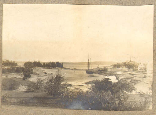
Lumber Schooner in the Cove
|
A prominent structure in the area and one that has been well photographed over the years, is the red boathouse on Conary Cove (some know to call it the LeVeque Boathouse), in Blue Hill Falls. It was built in 1924 by the Haskell family who summered in Blue Hill and was for the storage and repair of boats and was not a commercial boatyard. Prior to the early 50's it was white and subsequently modified and repainted red by the LeVeque family. Both photos below were taken by Nevill Smythe.
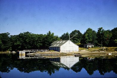
The LeVeque Boathouse ~1950
|
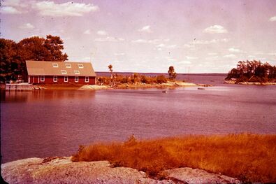
The LeVeque Boathouse in the late 1950's
|
|
|
|
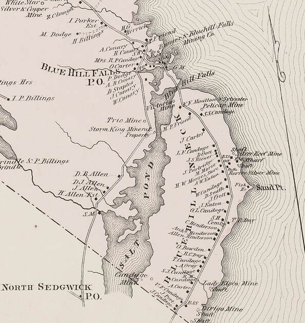
Hancock Country Atlas - 1881
|
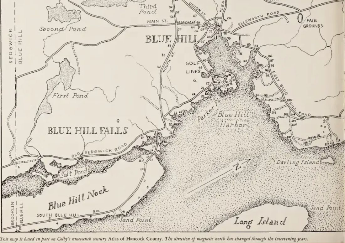
Blue Hill, Blue Hill Falls District and the Blue Hill Neck
- from Annie Clough's "Head of the Bay"
|
|
Something to Read
Want to know more about Blue Hill and Blue Hill Falls - the area once known was Tide Mill District? The attached book - Historical Sketches of Bluehill, Maine by R. G. F. Candage, was printed for the Bluehill Historical Society in 1905. It is a great detailed read and may shed light on a few things you might not know. Of particular interest may be the areas known as "The Neck" and Tide Mill District (or Neighborhood) which is specifically referenced on pages 3 thru 30 (1st para.). A quote from Page 14, "The Tide Mill neighborhood began at the Coggin lot (on Salt Pond Rd.) and extended to Bragdon's Brook and just beyond, where the schoolhouse stood in which the writer first learned to lisp his "A B C's." Some discussion on a bridge to the Neck occurred before 1842 and can be found on page 11. Additionally, one of the first settlers whose name was referenced as the location for what is today East Blue Hill, is noted on page 3, the 1st written page of the book. His name, Mr. James McHard (this spelling is correct). "McHards" became known as the village of East Blue Hill in 1871, but that area had always been a part of Blue Hill (and Plantation #5), though almost impossible to get to, as there was no road to that part of the town until the late 1870's. The road then built went down what is now York Rd. and then straight down a steep hill to the Jay Carter Rd. A private house and utility poles placed on the hill to the Jay Carter Rd. exist there now. The current RT 176 (East Blue Hill Rd.), from Woods Pt. to the village at the bridge, was a modification of that early road and was completed sometime in the early 1900s to bypass the hill. How things change.... The name "McHard" is also correctly referenced in the 2nd book attached below as an added benefit in getting this far. Please see and enjoy). A Correction in the book - "Head of the Bay" by Annie Clough, published in 1953. Page 41. Number 18: Manor House in Blue Hill Falls, was bought by Mrs. Samuel Ashhurst (corrected spelling) in 1926 from Mary B . McCreight, with a small adjacent property to the north purchased in 1927 from Chandler M. Wilson. Both were combined into one property. Mrs. Nevin had sold Manor House to Mary McCreight in 1914. |
|
|
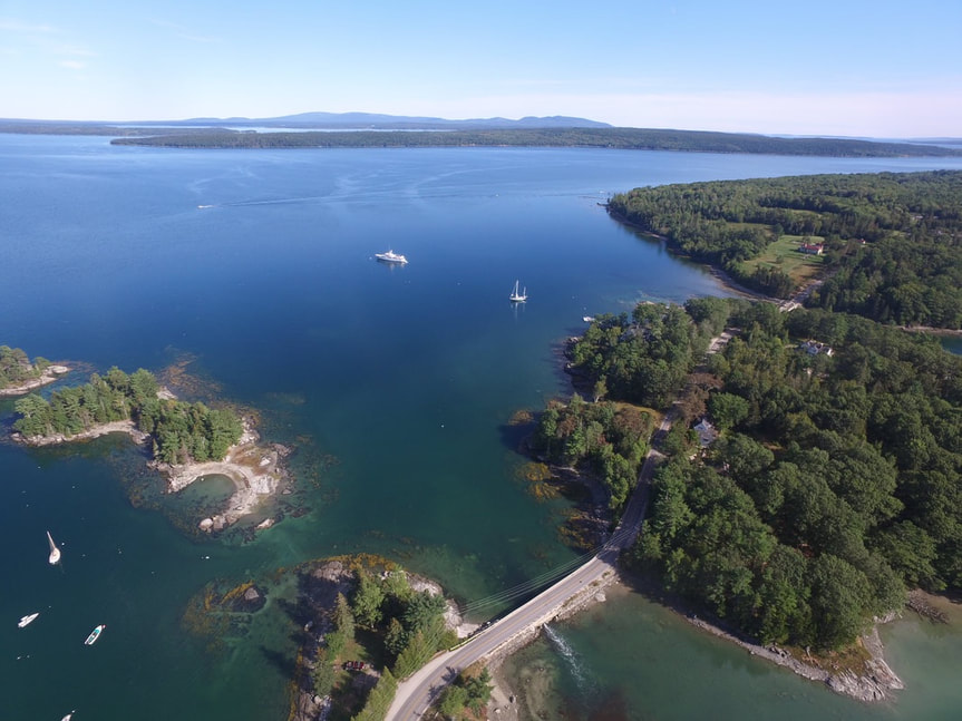
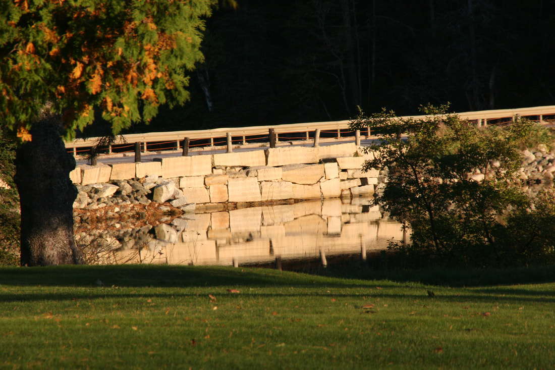
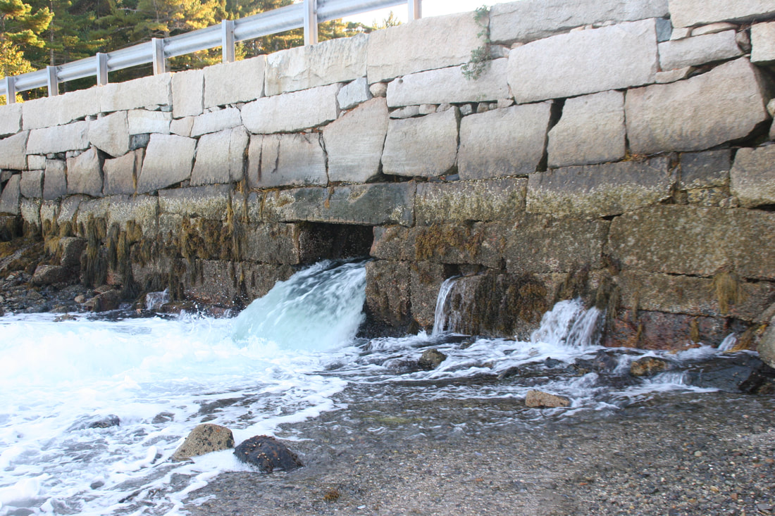
The Nub, The Mill Pond Dam and The Falls Bridge - between Mill Island and The Blue Hill Neck
|